Caudete de las Fuentes
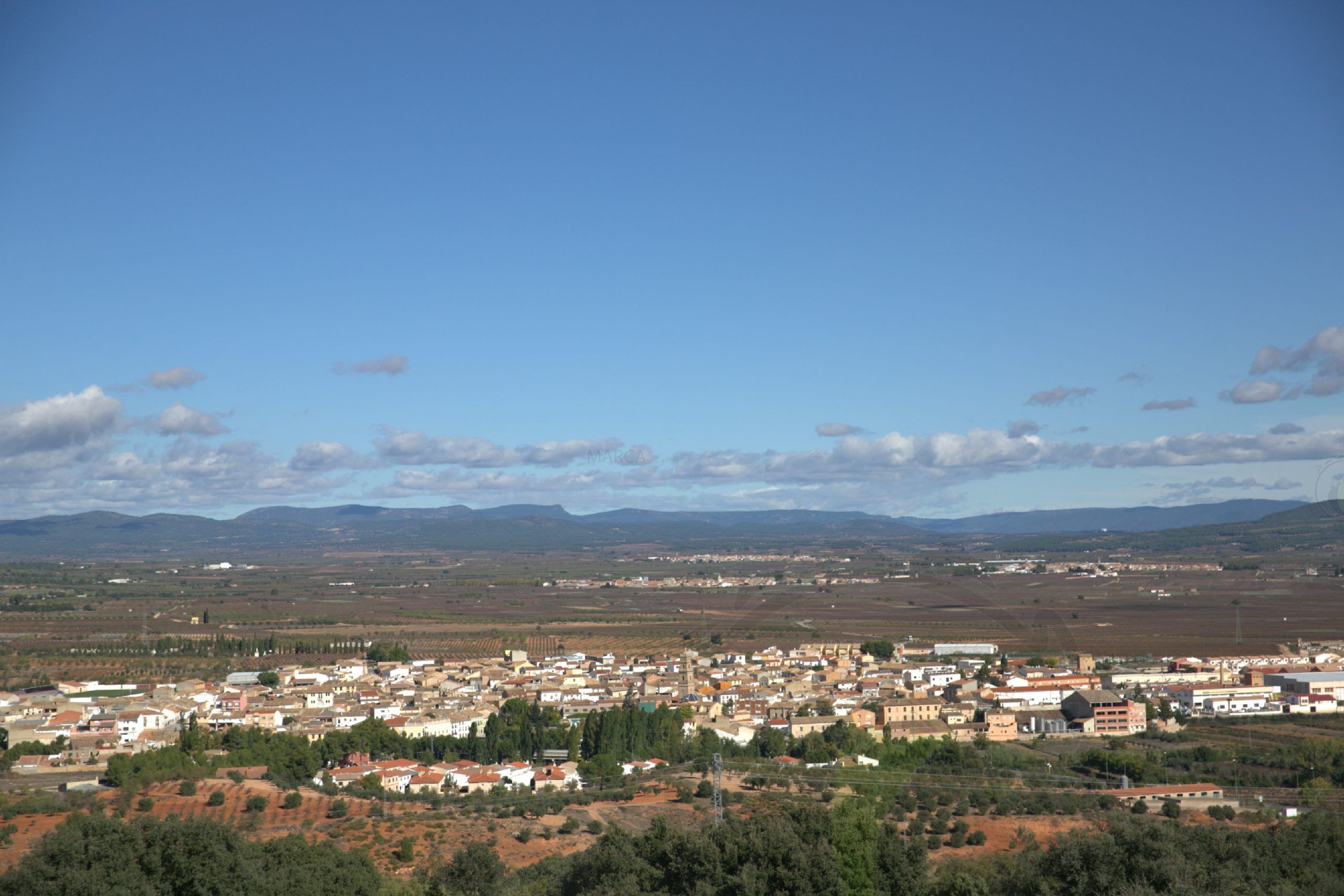
If anything characterizes Caudete de las Fuentes, it is its long history. This is due to its location on natural routes of communication between the plateau and the Mediterranean (“The Royal Cattle Road between Madrid and Valencia, also known as Las Cabrillas road”, in the words of Madoz), and the south and north of the peninsula (Castulone – Valentia by Egelesta. Possible “Ancient Way” of Strabo III,4,9. Rep 152. ). The area has been heavily-populated since the Bronze Age. There are remains of the site dating from this period at “Casa Doñana” and “Los Villares”, both of which were notable Iberian settlements that survived until the shortly before the change of era and which have offered highly interesting finds. A large amount of coins was found in “Los Villares”, their presence owing to the fact that the Iberian city had its own mint (it issued “asses” and “semis”).
In fact, it is one of the few places where it is possible to reliably follow the stratigraphic sequence of the archaeological sites from the Bronze Age (when the site experienced its greatest splendour with the installation of the Iberian City of KELIN, capital of Los Olcades) through to the subsequent Roman and Muslim periods and up until the present time.
Gastronomy:
Gazpacho, “morteruelo”, “ajoarriero” and “ajoaceite”, rolls (with ham and sardines), omelettes and “mantecados”.
Places of interest:
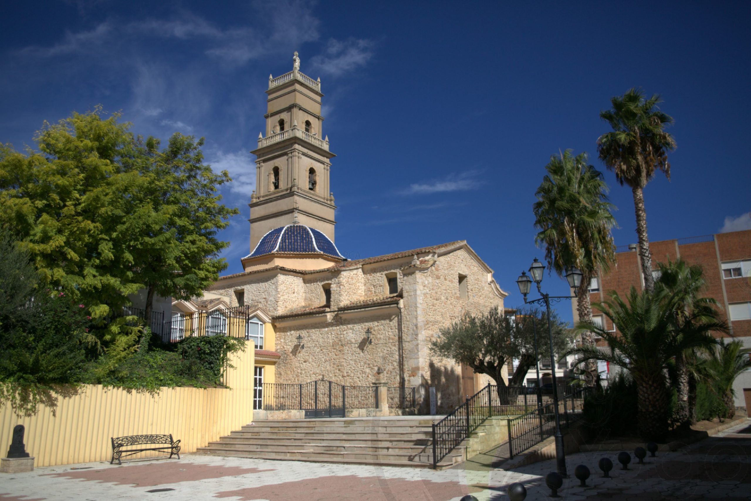
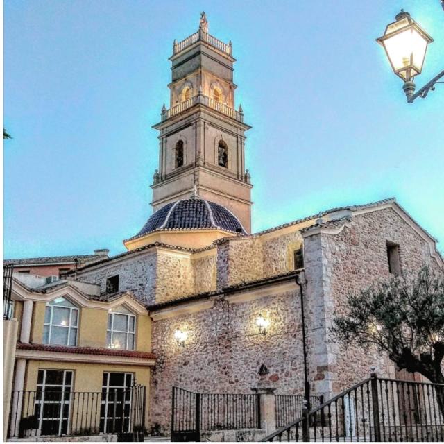
Parish Church of the Nativity of Our Lady
Construction began in 1731 and the church was consecrated in 1735. It is a rectangular, neoclassical building built in simple masonry and with a gabled roof. It has an octagonal dome set on an elevated thobolate, topped with a small pinnacle and a sphere. Inside the temple there is a single nave, with two sections of vault, plus the vaulted dome above the transept. The upper section of the vault houses the high altar, with an altarpiece dating from prior to 1939, as do its imagery and the side chapels of the nave, which open between the buttresses.
Activities and routes
The municipality lies within an area of outstanding natural beauty, and one in which an ever-growing number of projects aimed at converting rural tourism into the main local activity (second only to wine-making, of course…) are being implemented.
The area is composed of a geographic plateau that covers much of the interior of the province of Valencia. If we analyse the map of the plateau, it quickly becomes obvious that what we have is a double watershed:
- – North: La Vega del Magro
- – South: Las Ramblas del Cabriel
And, dividing the waters, “El Rubial” range together with Villagordo del Cabriel, and “La Ceja”, together with Caudete de las Fuentes.
The River Cabriel crosses the region from west to east, and in fact marks the border of the region, the province of Valencia and Valencia Region with Castile-La Mancha.
There are three parts in this area:
- – From Contreras until Los Cuchillos and Fuenseca, which corresponds to Villargordo del Cabriel, and which marks the beginning of Las Hoces.
- – Las Hoces, starting at La Hoz de Vicente and stretching to Vadocañas, with its Roman bridge, and where we can observe magnificent canyons. The area, which corresponds to Venta del Moro, also includes “Tamayo”, “El Tete”, “El Tochar” and “El Retorno”.
- – From Baños de Fuente Podrida to Casas del Río, where the River Cabriel is somewhat more “approachable”. This stretch, which corresponds to Requena, is where the two main ravines of “Albosa” and “Caballero” appear. This landscape, criss-crossed by gullies and streams and springs, has been populated since ancient times, as there are abundant Iberian sites and, perhaps, sites dating from the Bronze Age. It is interesting to note here the finding in the Iberian City of KELIN in Caudete de las Fuentes of several grape seeds in the remains of pottery, indicating the existence of a wine culture in the 5th century BC, perhaps related to the pagan cults of Dionysus or Bacchus.
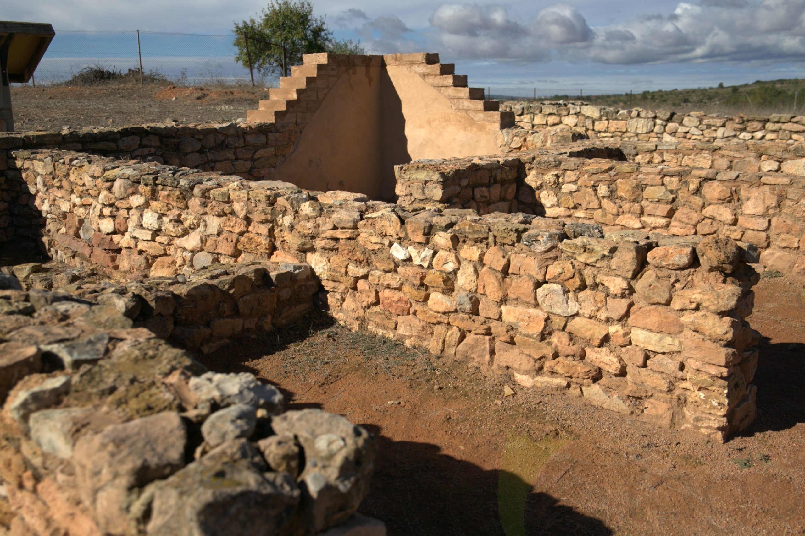
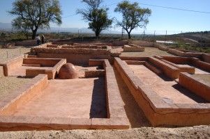
“Kelin” Iberian Settlement
Located on a small hill measuring about 850 m, and very close to the centre of the village. This Iberian site is one of the most important in the Valencia Region. It covers an area of some 10 ha., comparable in the period in question only with the settlements Arse (Sagunto), Saetebis (Xàtiva) and Edeta (Llíria). These dimensions confer on the site the status of “city”, as it was the capital of the rest of Iberian towns in our region and which is why, despite the current dual-capitals of Requena and Utiel, our village has been known since ancient times as “La Capitalilla”.
Festivities:
Numerous festivities and traditions, both Christian and pagan, are celebrated in our town, (Easter, “Mayos”, Saint Isidore, Palm Sunday, “Quintos”, Christmas, etc.). Thus, in addition to the name of “La Capitalilla”, our village is also known as Caudete “de las Fiestas”. Traditions include “La Pascua de Monas”, which consists of an excursion to the mountains to eat the typical “Mona de Pascua” on the first and the second Sundays of Easter.
There are two landscapes that form part of traditional excursions in Caudete de las Fuentes: “Los Pedriches”, on the first Sunday, and “La Fuentecilla”, on the second Sunday. Special mention may be made of three festivities, due to the large number of people that they attract. The first two correspond to the celebration of the village’s patron saints: Saint Anthony the Abbott (celebrated in January with a traditional bonfire in Plaza Mayor) and Saint Anthony of Padua (celebrated in June with a traditional meal for all the villagers courtesy of the Town Council).
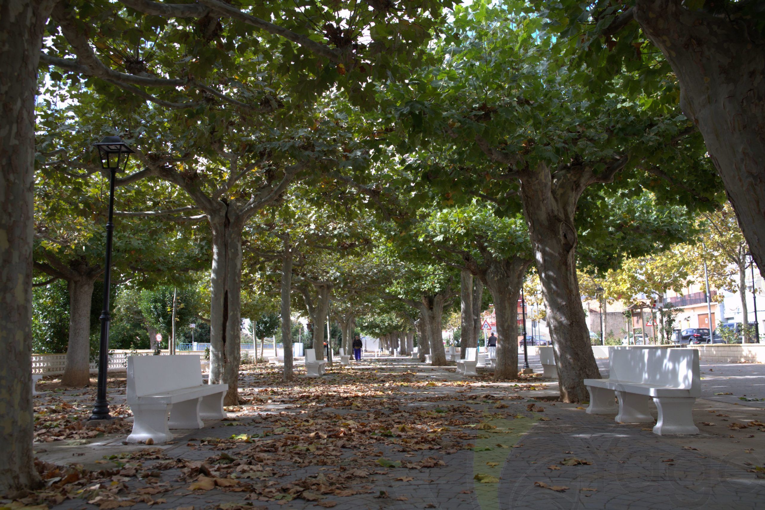
However, the most prominent and popular of our festivities are the Main Summer Festivities, known as “Cofraternity Week”, which are to celebrate their 33rd anniversary this year. It is usual for these festivities to bring together more than 7000 people in a single night. Their popularity lies in the popular street dances, which are free and which are held in Paseo de la Alameda.
