Quesa
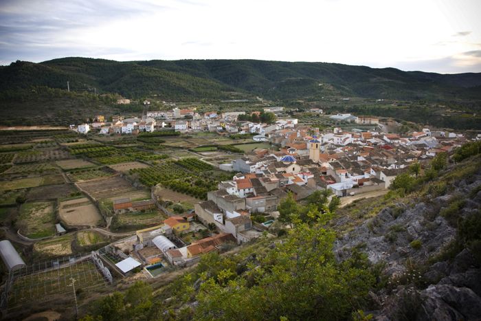
Quesa is a municipality with some 740 inhabitants, located in the administrative region of Canal de Navarrés and set in the heart of the Caroig Massif at an altitude of 300m above sea level. The municipality, which is large in comparison to the majority of those in the Valencia Region, covers some 7895 hectares, of which 68 are used for irrigation crops, 2884 for dryland farming, 1176 are covered with forests, 2322 are employed for grazing, 834 are unused and only 11 have been built upon.
It borders to the north with the municipalities of Millares and Tous, to the south with Navarrés, Ayora and Enguera, to the east with Navarrés, Bolbaite and Tous, and to the west with Bicorp and Ayora.


Gastronomy:
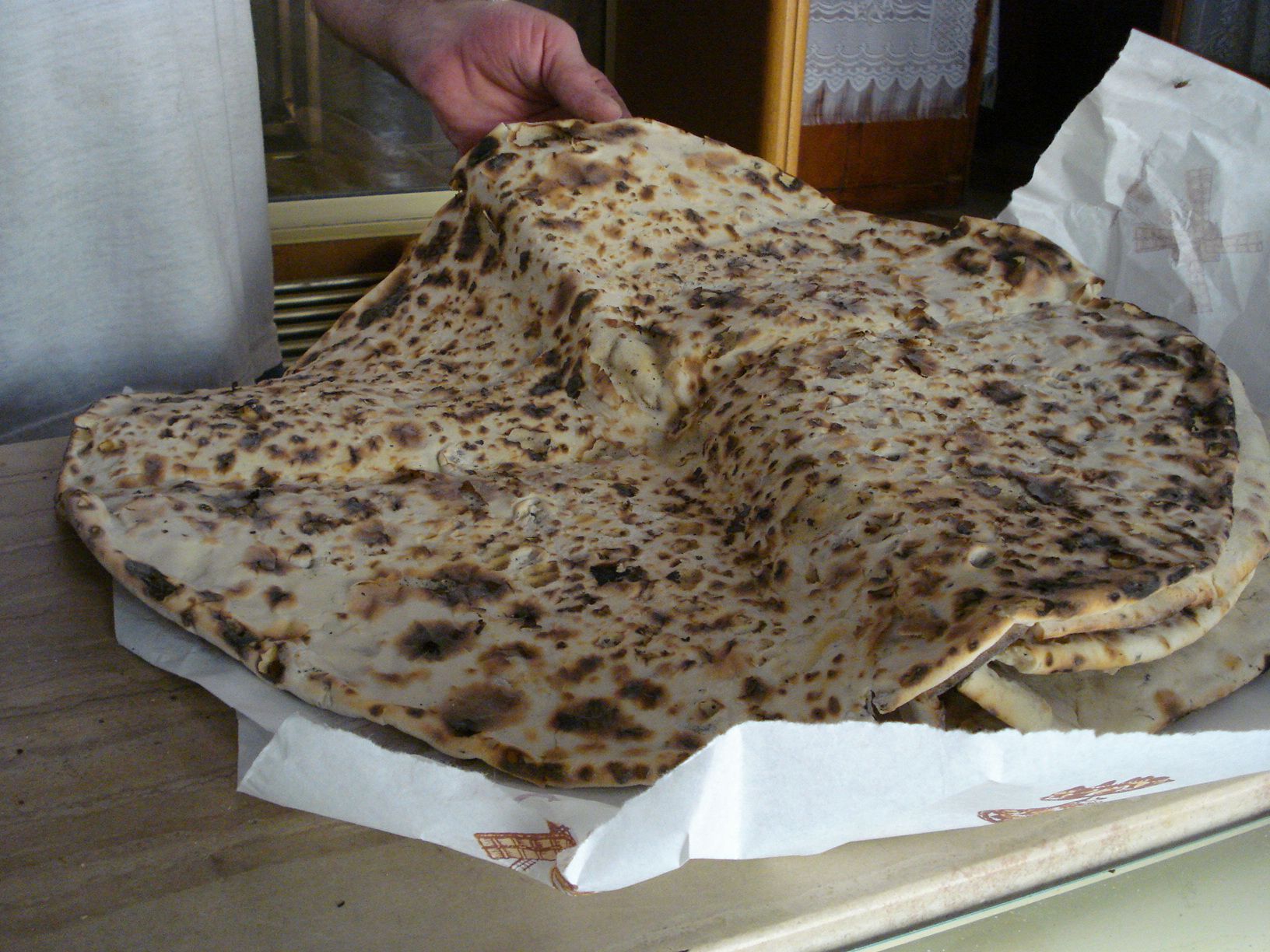
Local cuisine includes gazpachos, farinetes and guisote. Traditional sweet dishes include anise rolls, sweet potato pastries, pastries, Swiss roll and pa beneït, a special type of bread associated with the festivities of Saint Anthony. There is a family-run business in the municipality dedicated to the manufacture of these products.
Places of interest:
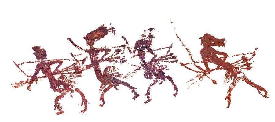
The municipality of Quesa has been inhabited by humans since remote times, proof of which can be found in prehistoric rock art present in 11 different locations. Special mention may be made of the rock art to be found at l’abric del Voro, which has been declared World Heritage by UNESCO. 65 anthropomorphic and zoomorphic paintings have been preserved at the site, the most notable which is the “Dance of the Archers”, which has been interpreted as representing a ritual dance. The paintings have recently been subject to a restoration and conservation process.
The village’s Arabic castle dates from a later period.
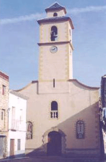
The parish church, dedicated to Saint Anthony the Abbot, was reconstructed in the 17th-century.
The Hermitage of the Holy Cross (18th-century).
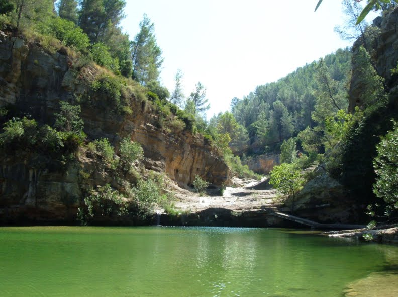
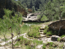
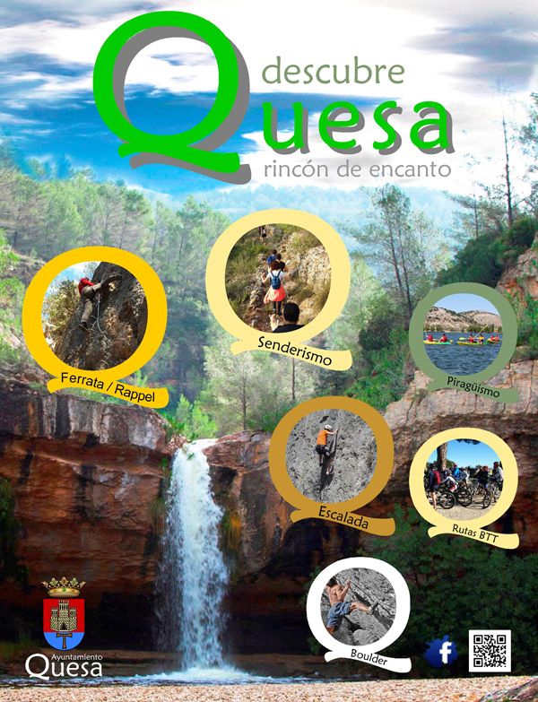
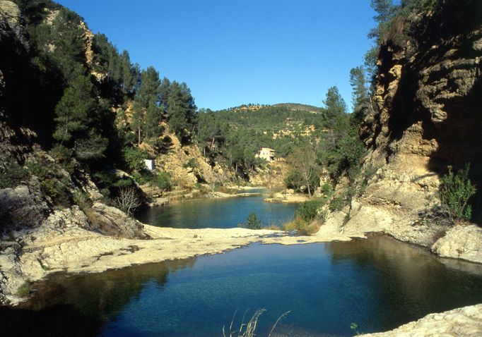
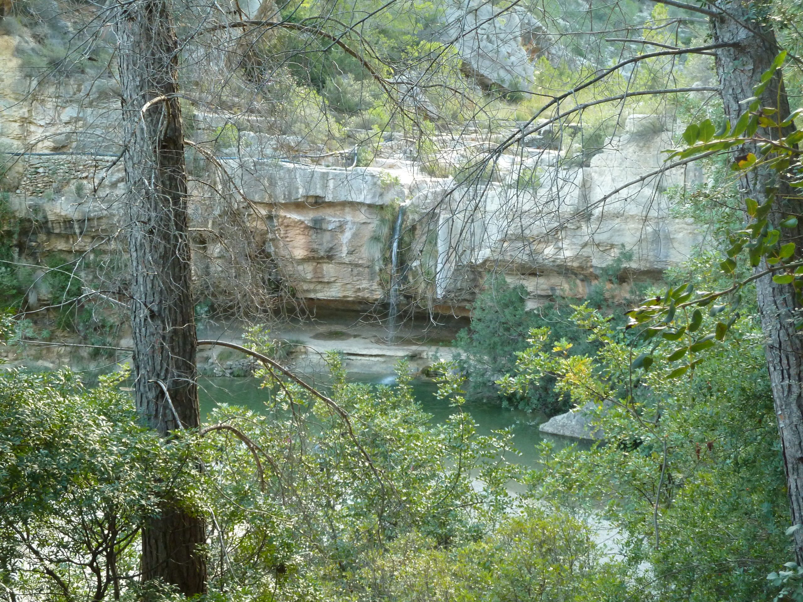
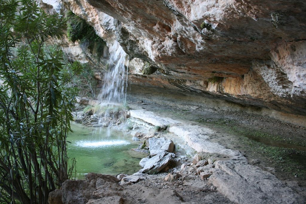
Quesa’s natural and landscape heritage includes the beautiful area known as Los Charcos, composed of cascading pools surrounded by mountains. Mention may also be made of the River Grande canyon and the River Cubillas. There are various short routes that can be enjoyed by those wishing to go walking in the area, and there also a via ferrata.
ROUTE PR – CV – 203 – ABRIC DE VORO
This beautiful route leads through lush pine forests and past enormous limestone cliffs, the so-called “Cinglas” and “Selda”, which have been capriciously sculpted by erosion and which host wild goats and eagles. Running along the feet of these cliffs is the River de las Cuevas, also known as River Grande. The path is immersed in a rich diversity of plant life, including different varieties of pines, strawberry trees, viburnum and narrow-leafed ash, as well as endemic orchids and many medicinal and aromatic plants; following the course of the river takes us to l’abric del Voro, where we can see a variety of paintings belonging to Levantine Rock Art, declared World Heritage by UNESCO, and among which mention may be made of “the four archers representing a dance. Once l’abric del Voro has been left behind, the path leads through a large forest known as el Planil and past the ruins of a house known as Casa Eliseo, outside which stands a centuries-old fig tree. The route then returns to its starting point at the Horteta pool.
For further tourist information about Quesa: www.quesa.es
Festivities:
Saint Anthony, 17th January. A bonfire is prepared in honour of the patron saint of the Quesa church on the eve of the celebrations, and on the following day blessed bread is distributed and animals are blessed.